In 2016: QGIS Server will speak INSPIRE
Par René-Luc D'Hont le lundi 4 avril 2016, 09:43 - Système d'Information Géographique (SIG) - Lien permanent
February 26, 2016, QGIS version 2.14 has been created, version 2.14.1 has been released. This version is the second Long Term Release or LTR in the QGIS history. This version will be maintained for at least 1 years until the publication of the next LTR which will be version 3.2.

QGIS Server side, this version incorporates many changes for better compliance with standard including the ability to publish Web Map Services or WMS compatible with the INSPIRE Directive. I would also like to thank the company NeoGeo Technologies and its tool: WMS INSPIRE tester.
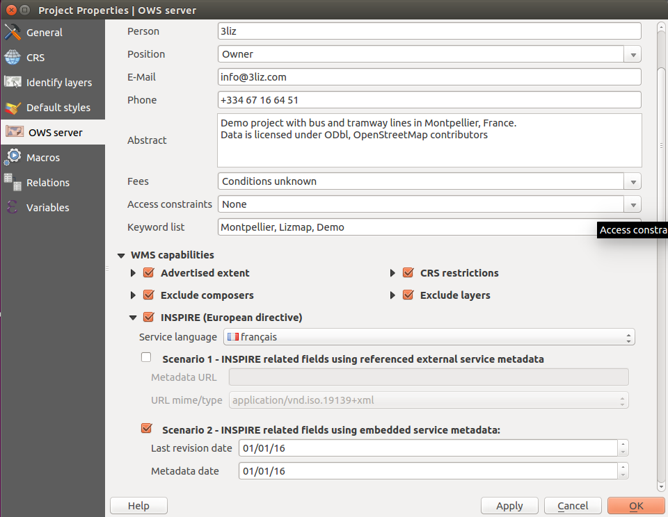
![]() So you will find in the project properties window, in OWS tab, a new section to configure the WMS associated with this project to be INSPIRE compliant.
So you will find in the project properties window, in OWS tab, a new section to configure the WMS associated with this project to be INSPIRE compliant.
You can specify the language of publication of the Web Map Service. You must select a language in the official list of the European Union languages to which was added 3 local languages. You can then choose a method of defining INSPIRE metadata of the Web Map Service:
- either by indicating the URL of the INSPIRE metadata record of the Web Map Service
- either by indicating the dates of creation/correction of the service and metadata
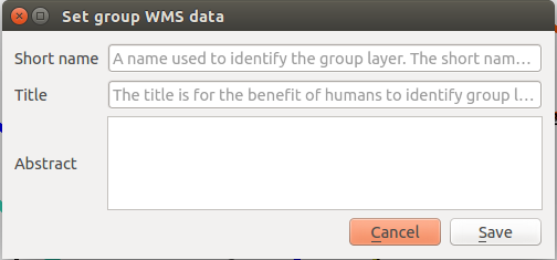
To support this new feature, it was also added the ability to specify a short name for the layers and short name, title and description for groups. The short name has been included in the description of layers to allow to define a name for the Web services that are different from the name used in the desktop interface. The name of a layer in a Web Service is a text for communication between software, the title is for users. It was therefore important to differentiate the name to use within Web Services: the short name; the name to use QGIS desktop and the title. The same possibility was added to groups and the project.
Another feature designed to help configure the OGC Web Services for QGIS Server: Configuration checker.
This feature was funded by Ifremer. You will find it in project properties, in OWS tab at the bottom of the window.

Other features have been added such as:
- ShowFeatureCount the parameter in the query WMS GetLegendGraphics
- StartIndex the parameter in the query WFS GetFeature
For more information on all new to QGIS version 2.14, you can view the QGIS changelog for version 2.14.